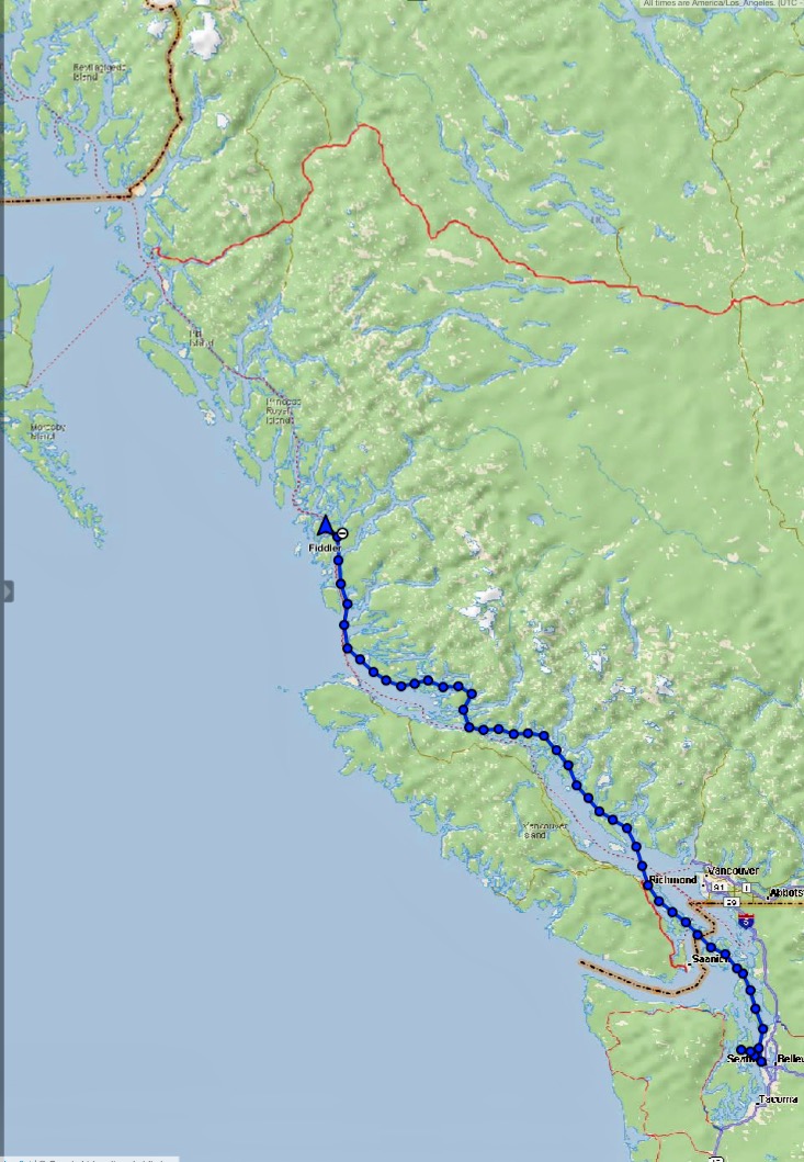
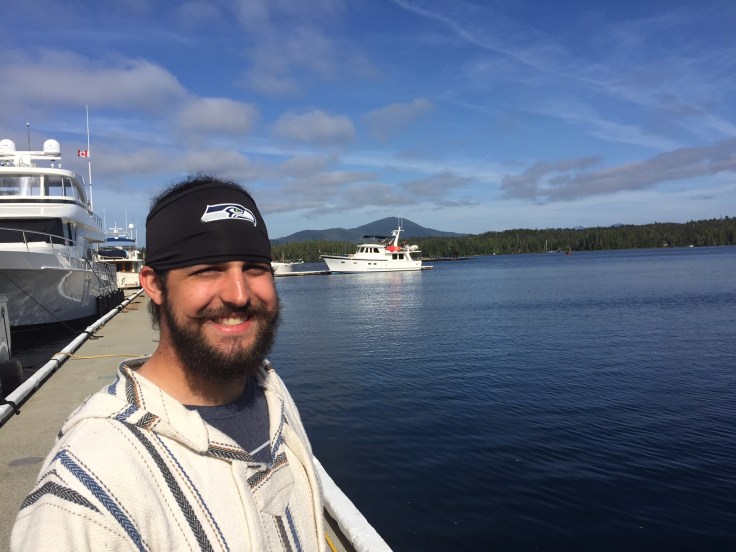
On May 17, Alec and I left Seattle’s Elliott Bay Marina to cruise on Fiddler for three weeks up the Inside Passage to Ketchikan, AK. Ten days later we docked at Shearwater Marina in northern British Columbia, the approximate half-way point in terms of days. We have traveled 475 miles of the 750 mile trip, so we are 63 percent of the way there.
The weather has been excellent with generally calm seas and only one day of rain, allowing us to make very good progress. Good progress was needed during the first week in order to get us through the reversing tidal rapids north of Desolation Sound. We needed to get through them before the much higher spring tides occurring during the full moon phase the following week. The spring tides cause much faster currents in the rapids and a smaller window in which to transit them safely. So the first few days had us under way a little longer than usual.
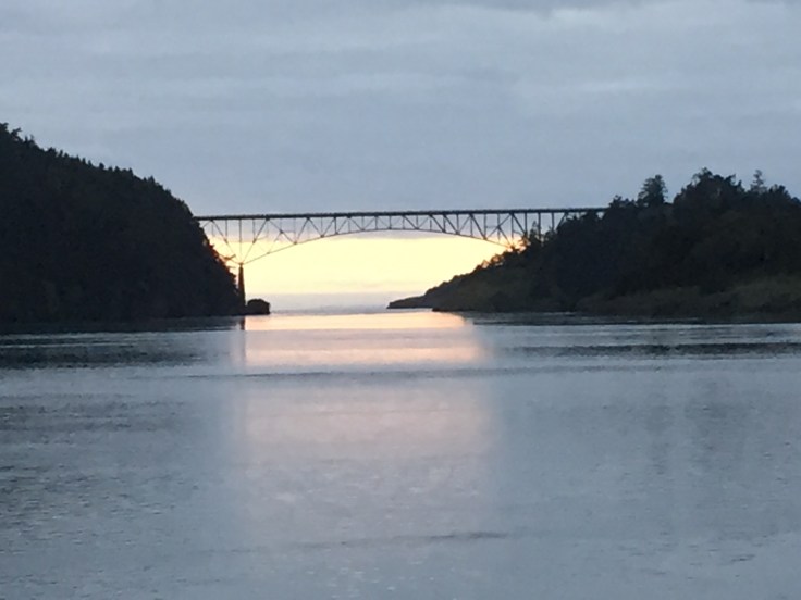
The first day we left at 2pm and at the 8:30pm sunset we docked at Deception Pass State Marine Park.
We were up early the next day and cruised through the San Juan Islands and crossed into British Columbia, clearing customs and continuing to Telegraph Harbour Marina in the Gulf Islands. We got here in time to do some kayaking in the calm bay.
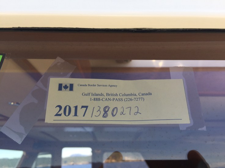
In order to clear customs on a boat, we dock at a designated location and either call in or meet a customs officer in person. In this case we phoned in from the dock and cleared in a matter of minutes. No weapons, drugs, tobacco, etc. Good to go. Also clearing customs was an organized flotilla of six boats chartered from and led by NW Explorations, called the Mother Goose flotilla. They were also going to Ketchikan. They left shortly after us, but their faster boats soon overtook us, swamping us with their wakes. They should have given us a little more room.
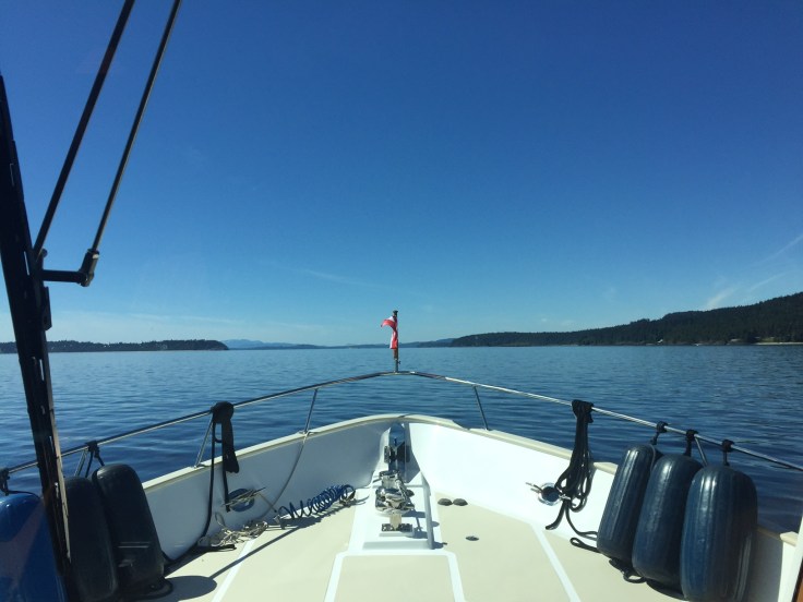
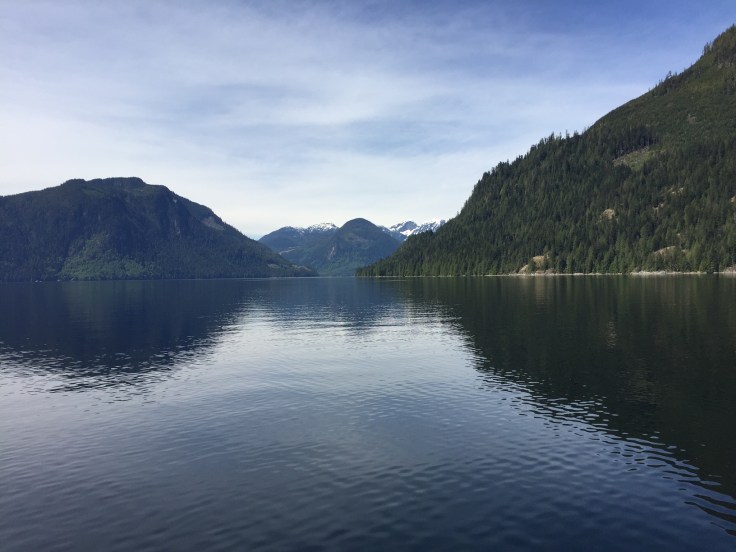
We were up early in order to cross the Strait of Georgia over to the mainland. It is a large body of water that can be very rough and dangerous. Typical afternoon winds make for an uncomfortable crossing later in the day. The direct route takes us through a military area where they practice with live torpedoes. I radioed the Canadian Coast Guard to see if they were active. If so, I would have to go around the practice area, a much longer trip. Fortunately, they were not active.
We stopped in Pender Harbour, topped off the fuel tanks, and anchored in Garden Bay. We took the dinghy out for a ride around the area and then over to John Henry’s café for dinner.
We spent the next night at Squirrel Cove in Desolation Sound and in position to cross the rapids the next day. We had made very good time to get here with longer times under way and also banking two planned weather days that weren’t needed.
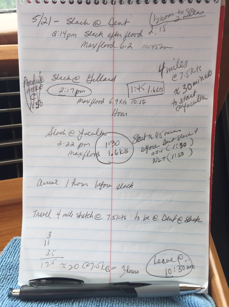
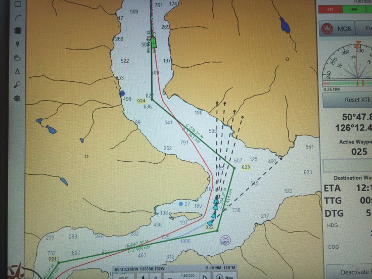
We arrived at the first of the three rapids about 30 minutes early and could see they were moving very fast. The fastest and most dangerous of the three rapids is Dent Rapids, the one farthest north and the last one to transit. It must be transited at slack, the time when the current stops and then reverses direction with the change of the tide. This means we have to transit the other two while the currents are still running. It takes about 15 minutes to get through the Yuculta Rapids first, then Gillard Rapids next, and if timed correctly, we arrive at Dent Rapids two miles later at slack. We idled around for 30 minutes until the time I had planned to go through. As we pushed against the currents of Yuculta Rapids, we watched eagles diving into the waters for the fish being churned up by the turbulence. We also had to dodge logs and other debris, and another boat coming through the other direction. Fifteen minutes later we went through Gillard Rapids and had 15 minutes to get the two miles to Dent Rapids at slack. Whew, the timing worked out well and we got through them all with no problem!
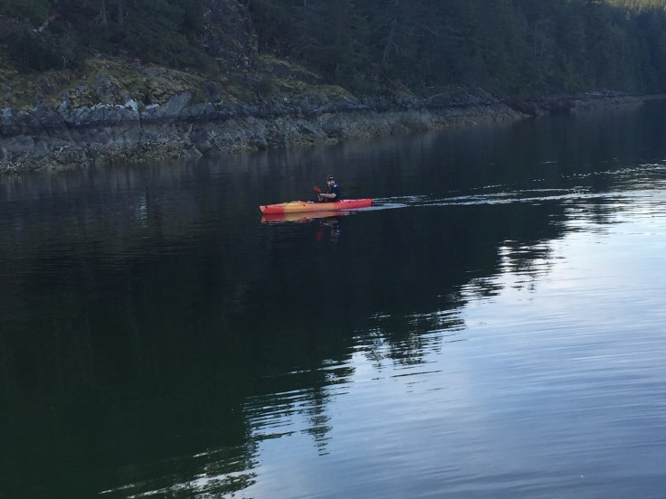
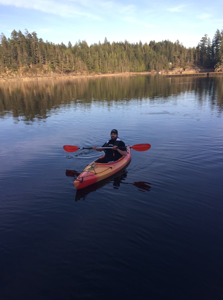
We anchored for the night at Cordero Islands, a scenic and protected cove. We kayaked in the cove and enjoyed seeing the rich marine life including colorful sea anemones and sea urchins. There were also a ton of seals. We have traveled 250 miles thus far.
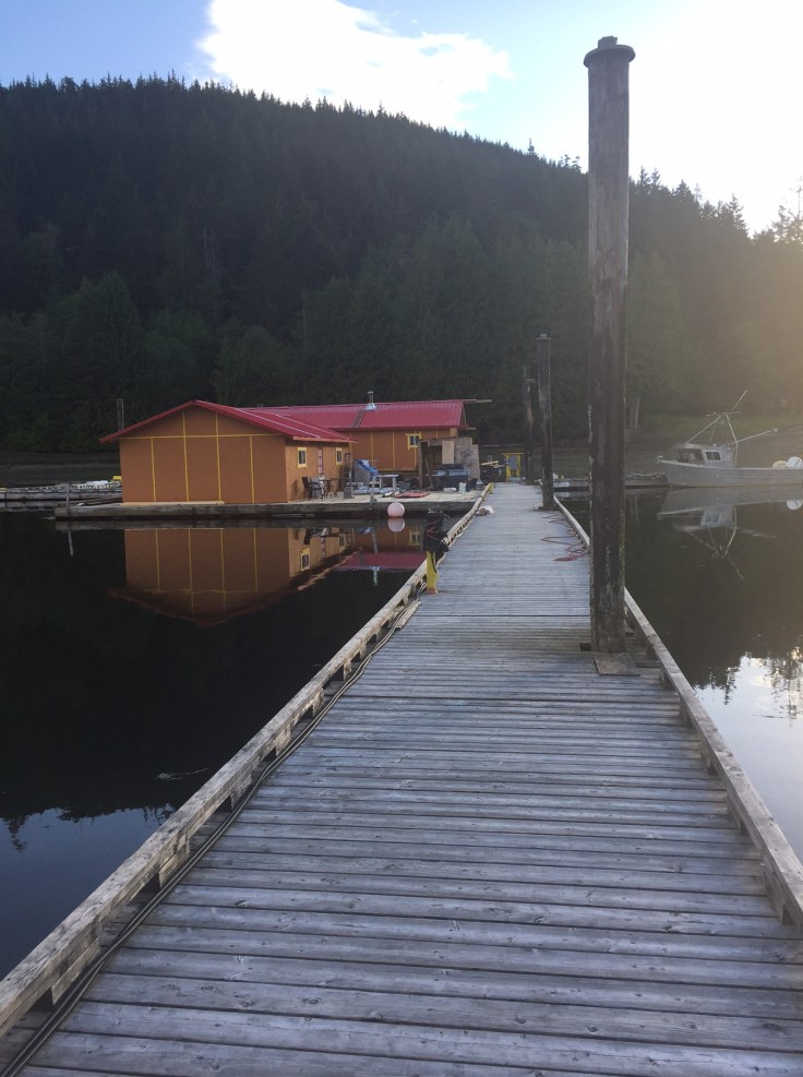
The next three days we worked our way through the Broughton Islands stopping at Port Harvey Marina, Kwatsi Bay Marina, and Sullivan Bay Marina. Our favorite of the three was Kwatsi Bay. It is very remote and at the head of a fjord like bay with high mountains and waterfalls all around. The dock is small and operated by a couple that have lived there for 21 years and raising their two girls. Shortly after we docked, thinking we had the place to ourselves, the Mother Goose flotilla shows up and takes up the remaining dock space. Max, the marina owner, invited us all for happy hour on the dock, a usual activity at these small venues. Mother Goose didn’t want to participate so Alec and I invited Max to our boat for chips, salsa, wine, and cheese. We had a very nice time and it was interesting to learn about Max and his family and Kwatsi Bay. We will definitely return here.

We left the Broughton Islands and prepared for the first of two open ocean legs, going around Cape Caution. We worked our way to Skull Bay, anchored, but didn’t like it and it was too windy. We moved to nearby Allison Harbor that was bigger and better protected. The weather was not good for rounding Cape Caution the next day so we took a weather day and crabbed and kayaked. We caught and cooked five Dungeness crabs.


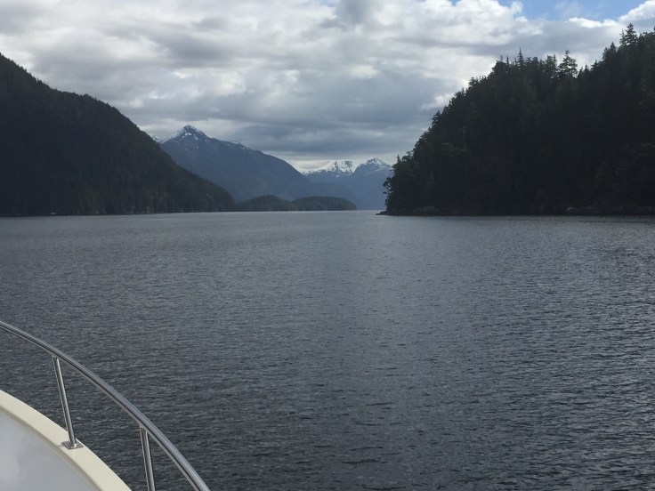
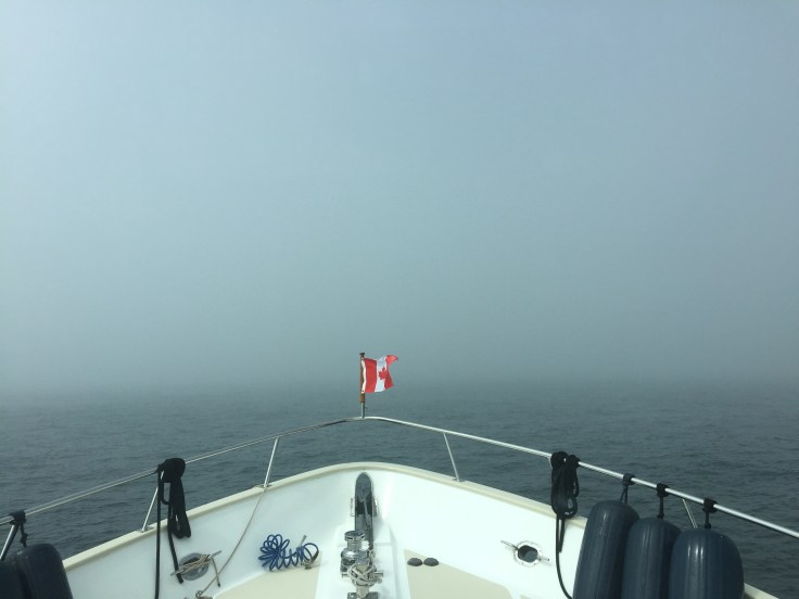
Everything looked good for crossing the next day. While we will always be in sight of land, the 30 miles or so is exposed to the swells and winds coming off the Pacific Ocean until we can get back to the shelter provided by the islands of the Inside Passage. Factors to determine whether to go or not include wind speed and direction, flood or ebb tide, wave height, and wave period. There are two large inlets near Cape Caution that, on an ebb tide, firehose water from the inland waterways into the ocean creating dangerous wave heights and washing machine action. We waited for the flood tide when the water was flowing inland. Despite our best efforts, the passage was still uncomfortably rough and in heavy fog. I found out later it was due to the lingering effects of an offshore storm.
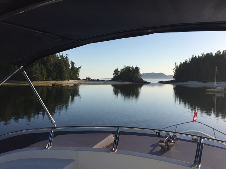
Once past Cape Caution, we were in northern BC and safely anchored for the night in Fury Cove. Fury Cove was beautiful and serene. We kayaked to the shell beach to explore and the weather was perfect.

Skull Bay, Cape Caution, Fury Cove…these names should tell me something.
The next day we cruised 51 miles to Shearwater to reprovision, refuel, and eat in a restaurant.
We are a few days ahead of the planned itinerary and have only used one weather day. But we may need them to wait for acceptable conditions for the next open ocean crossing into Ketchikan.

It looks so beautiful! I love your blog. Keep it coming!!
LikeLiked by 1 person